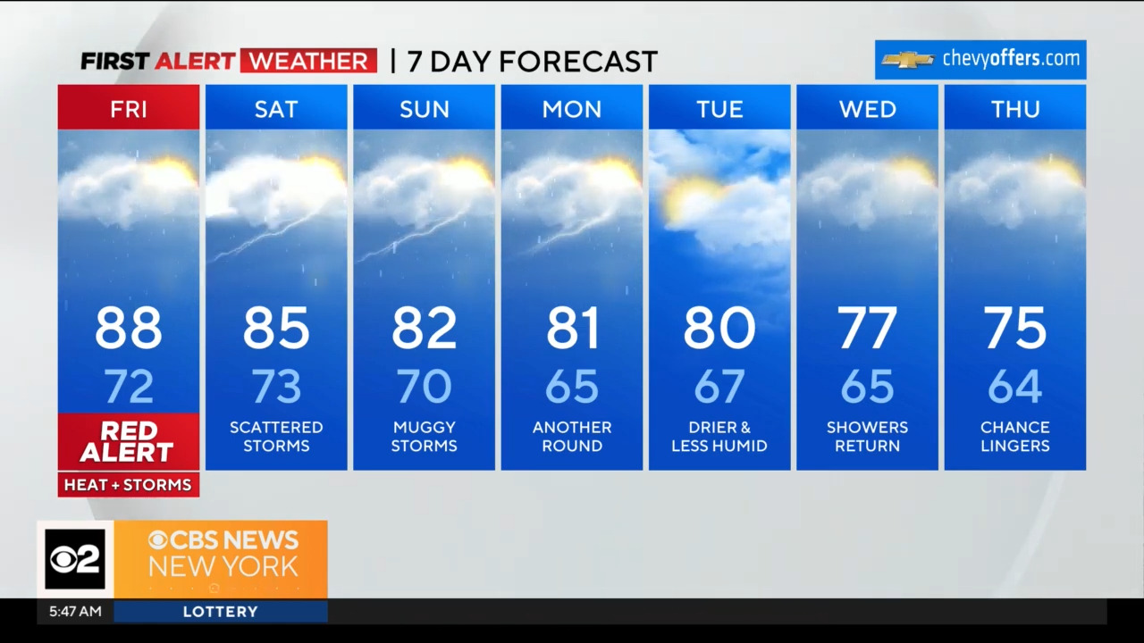
As the scorching heatwave finally relinquishes its grip, the National Weather Service has issued a crucial alert for late-day Friday and Friday evening. Brace yourselves, as another round of showers and strong storms is set to sweep across the region, marking the end of this oppressive heat spell.
Preparing for the Front’s Fury
The impending severe weather event is closely associated with the arrival of a cold front. This weather-maker promises not only to quell the relentless upper 90s and low 100s we’ve endured but also to bring with it the potential for significant storm activity.
The National Weather Service is closely monitoring this situation and has designated different risk levels for various areas. Baltimore City and points to the north are under a SLIGHT (2 of 5) RISK of severe weather, while areas south of Baltimore are under a MARGINAL (1 of 5) RISK. This classification takes into account the probability and intensity of severe weather, urging residents across the region to exercise caution and stay informed.
Timing the Storms
According to the National Weather Service’s forecast, the prime time for strong storms to roll through the region will be from west to east, spanning roughly from 6 PM through Midnight on Friday evening. While the weather is inherently unpredictable, the Futurescan Computer Model provides valuable insights into the anticipated timeline.
What to Expect
So, what exactly does this severe weather outlook mean for you? Let’s break it down:
Rain and Thunderstorms:
Anticipate widespread rainfall and thunderstorms across the region. These storms may bring heavy downpours, leading to localized flooding in low-lying areas. Be prepared for sudden changes in weather conditions and reduced visibility if you’re out on the roads during these hours.
Strong Winds:
Severe storms often come with strong winds capable of causing damage to trees, power lines, and structures. It’s advisable to secure any loose items around your property to minimize the risk of damage.
Hail:
Though not guaranteed, hail is a possibility during these storms. Keep your vehicles in a sheltered area if you can to protect them from potential hail damage.
Tornadoes: While the overall risk is low, tornadoes can’t be ruled out entirely, especially in areas under a SLIGHT risk. Stay tuned to local news and alerts from the National Weather Service for any updates regarding tornado watches or warnings.
Lightning:
Thunderstorms are often accompanied by lightning, which can pose a significant threat. Remember to stay indoors and avoid open areas during storms to reduce the risk of being struck by lightning.
Stay Informed and Prepared
To ensure your safety during these potentially severe weather conditions, here are some essential tips:
Stay Connected:
Keep a weather radio or a reliable weather app on your mobile device handy to receive real-time updates from the National Weather Service.
Emergency Kit:
Have an emergency kit ready, including non-perishable food, water, flashlights, batteries, and a first-aid kit.
Charge Devices:
Charge your cell phone and other electronic devices in case of power outages.
Stay Indoors:
If severe weather hits while you’re outdoors, seek shelter immediately. Avoid driving unless absolutely necessary.
Monitor Local News:
Keep an eye on local news channels and the National Weather Service’s official updates for the most current information.
The National Weather Service plays a pivotal role in keeping us informed and safe during severe weather events like this. Their dedicated team of meteorologists works tirelessly to provide accurate forecasts and timely alerts to help us prepare for and respond to these situations.
As we anticipate the arrival of Friday’s severe storms, remember that preparedness and vigilance are our greatest assets. Stay safe, stay informed, and let’s weather this storm together.


Leave a Reply